Happening Now
The Charlotte Street Road Diet continues to show signs of success since its implementation in 2019. The second year of “Post-Implementation” analysis reveals that the project has reduced traffic speeds, increased bike use, and reduced the number of automobile collisions on Charlotte Street with no indication of increased cut-through traffic on the side streets.
Background
Road Diet and Spot Safety Improvement Project is Complete.

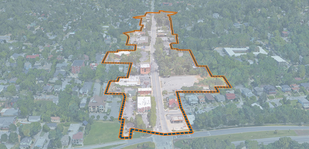
The scope of this project, which was designated by City Council, included a 4 to 3 lane conversion, milling and repaving Charlotte Street from Chestnut to Edwin Street, multimodal bike improvements and spot safety improvements. This project did not include sidewalk, place making, significant stormwater or utility improvements.
(see page four for Council direction.)
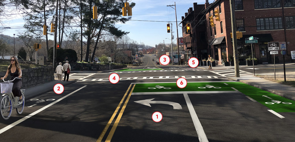
Charlotte Street Road Diet and safety improvements
- North and South bound lanes, center turn lane
- Beginning North bound bike lane
- Ending of South bound bike lane, transitions to shared lane markings (sharrows)
- High visibility crosswalks and pedestrian signals
- Stamped “brick” asphalt to transition bike lane, provide visual enhancement, and “buffer” between traffic and the sidewalk
- Green bike boxes for safe bicycle movements
Zoning and Development
The City collected base information and public input on the current zoning and overlay district during community planning for the Road Diet and Spot Safety project. This was performed in response to Council and community interest in potentially adjusting development standards along the Charlotte Street corridor to help guide future growth. That information is available via the resources section below. City staff does not anticipate any further analysis of the information or recommendations on zoning at this time.
Resources
Meetings
Public meetings were held The Jewish Community Center at 236 Charlotte Street.
Contact Information
Jessica Morriss, Assistant Director of Transportation Department
jmorriss@ashevillenc.gov
Last Updated 9/8/2022
